
Across Australia’s terrain, not all surfaces are as easy to explore as others. Modern surveying and utility operations often encounter data loss, equipment failure, and workflow delays due to harsh outdoor conditions and extreme climates. This is where rugged field mobility is essential for accurate and reliable fieldwork. Purpose-built tablets, handhelds and mobile computing devices withstand heat, moisture, dust and impact while supporting high precision spatial data capture, unlike commercial tablets, which often fail in the field.
For utilities and asset-intensive organisations, real-time data improves maintenance decisions, reduces travel time and minimises rework. With the Australian surveying and mapping industry projected to reach $3.9 billion by the close of 2025, dependable field mobility equipment has become crucial for delivering clean, instantaneous, and accurate data.
Who Rugged Field Mobility Is For
Rugged field mobility supports professionals working in harsh outdoor conditions, including surveyors who use GNSS, total stations, and laser scanning tools; utilities personnel performing asset inspections; and asset managers updating GIS, CMMS, or EAM systems. These teams require reliable hardware that seamlessly integrates with spatial and inspection software to maintain accurate and efficient workflows.
Implementing rugged mobility typically involves selecting rugged devices and accessories, completing setup and configuration, training field staff and providing ongoing integration and fleet support to ensure consistent performance in the field.
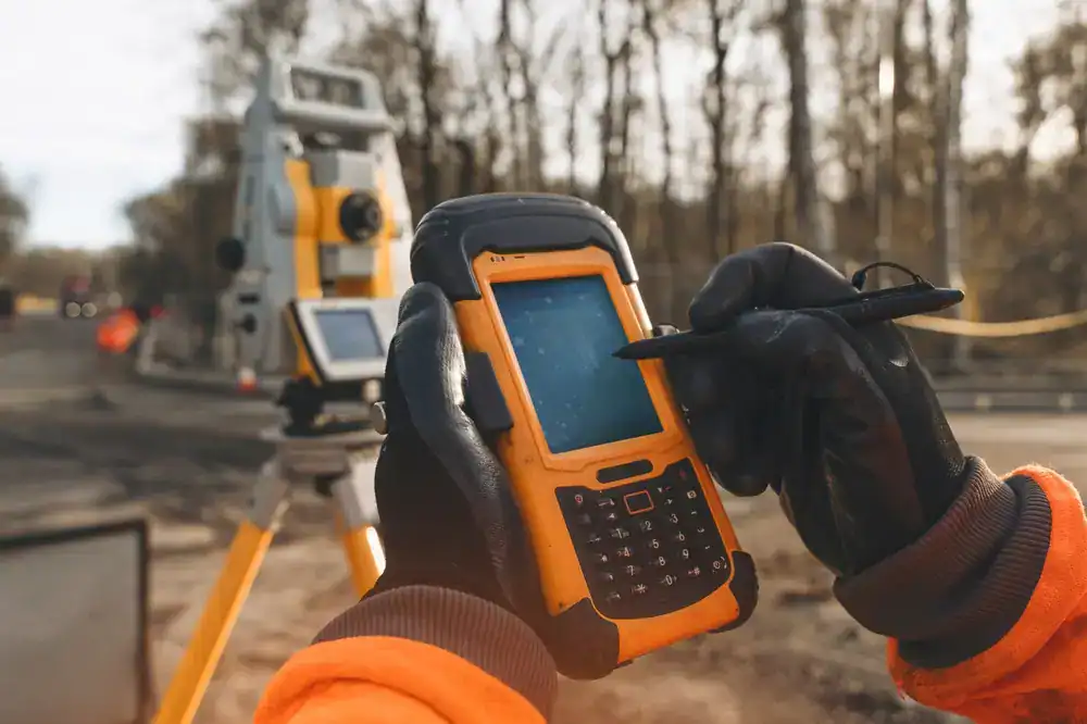
How to Choose the Most Reliable Rugged Tablet for Land Surveying
When selecting a rugged tablet for surveying, start with these criteria:
- Durability credentials: Look for MIL-STD drop ratings, IP-class protection (e.g., IP65/66) and ability to operate across a wide temperature range.
- Screen readability: A bright display (e.g., 1200 nits) and a mode for gloved use or wet conditions ensure field usability.
- GNSS/positioning integration: Built-in GNSS receiver supporting multiple constellations (GPS, GLONASS, Galileo) ensures high positioning accuracy.
- Connectivity & sensors: WiFi 6E, Bluetooth 5.x, optional 5G, dual-SIM, and rugged I/O ports support data transfer even in remote or vehicle situations.
- Field software ecosystem: Ensure compatibility with surveying, GIS, inspections, and asset management apps, and provide offline capabilities.
- Training & Support: The device is only as good as the team using it; training, device management, and accessories (such as vehicle mounts and spares) are crucial.
By applying this checklist, survey- and asset-based organisations can select devices that match their applications rather than compromise with consumer equipment.
What Is the ROI of Rugged Mobile Devices in Utility Inspections
The return on investment (ROI) for rugged mobile devices in utilities flows from several tangible benefits:
- Reduced travel and turnaround time by field crews due to real-time data capture and upload. For example, spatial analysis solutions for utilities claim to reduce field operation costs through smarter routing and fewer manual inspections.
- Fewer re-works or delays due to more accurate data capture, fewer transcription errors and faster decision-making.
- Extended device lifetime and lower total cost of ownership compared to consumer-grade tablets prone to failure in harsh conditions.
- Improved regulatory compliance and audit readiness from geo-tagged, timestamped data captured in the field.
- Better workforce productivity and safety outcomes because crews are adequately equipped for the job.
For utility asset managers, this means completing more jobs per day, reducing unplanned service disruptions, and achieving stronger asset-management outcomes tied to field mobility deployment.
How Rugged Handhelds Improve Asset Management Data Accuracy
Asset-rich organisations rely on timely and accurate data from field inspections, condition assessments and change-management workflows. Rugged handheld devices form a critical link between the field and the office, and help maximise the value of asset-management investments.
Rugged handhelds enable:
- On-site capture of asset condition, location, photo, barcode or RFID tag, and immediate upload to enterprise systems.
- Integration with GIS, CMMS or EAM systems so that updates made in the field are reflected immediately in the asset register.
- Reduced manual transcription errors because field data is entered electronically rather than handwritten forms. Evidence shows mobile apps improve data accuracy and workflow efficiency.
- Offline capability: field workers often operate in remote or disconnected locations; rugged handhelds with offline mode ensure data capture regardless of connectivity.
- Traceability and compliance: captured data is geo-tagged and timestamped, supporting audit trails and regulatory reporting.

The Digital Transformation of Field Data Capture
Field data capture is no longer a paper-based exercise followed by back-office transcription. The digital transformation of field work involves:
- Real-time connectivity and cloud synchronisation of field data.
- Use of GNSS, laser scanners and mobile computing devices to collect spatial data, create 3D models and feed into GIS/BIM platforms.
- Deployment of rugged devices that support these workflows and cope with outdoor conditions.
- Integration of field mobility apps, inspection software, and asset management systems, enabling field crews to contribute directly to enterprise data streams.
- Shift from reactive maintenance to predictive and condition-based workflows, supported by accurate field data and analytics.
For organisations that successfully adopt rugged field mobility, the outcome is streamlined operations, improved data quality and enhanced decision-making.
Why System Integration Matters in Rugged Mobility Deployments
Deploying rugged field mobility is not just about buying devices; it’s about integrating hardware, software, connectivity and people into a seamless system. Critical factors include:
- Ensuring the rugged tablet or handheld integrates with GNSS receivers, laser scanners, GIS and mobile apps.
- Configuring data flows from field devices to enterprise systems (GIS, CMMS, EAM, BIM).
- Managing device lifecycle, updates, calibration, network connectivity and security controls.
- Training the field workforce and supporting change management to shift from legacy processes to digital workflows.
- Establishing maintenance, accessory provisioning and spare-device strategies to avoid downtime.
Common Challenges When Using Consumer Tablets for Surveying
Consumer devices generally lack environmental protection, GNSS accuracy and connectivity suited to surveying. They have shorter lifespans, fewer mounting options and limited enterprise support. These limitations increase downtime, raise the total cost of ownership and compromise data reliability.

How Utilities Can Future-Proof Their Field Data Collection Systems
To ensure field mobility systems remain effective over time, utilities and asset operators should:
- Choose rugged devices with proven durability and long-term support for operating systems and security updates.
- Ensure devices are GNSS-enabled, connectivity-ready and compatible with future field software updates.
- Develop modular field mobility solutions that allow devices, mounts, accessories, and software to be upgraded without requiring wholesale replacement.
- Integrate training and change management into field deployments to ensure crews effectively adopt new tools and workflows.
- Integrate training and change management into field deployments to ensure crews effectively adopt new tools and workflows.
- Monitor device performance, asset inspection outcome metrics, and workflow efficiency to measure ROI and refine deployment.
Industrial vs Consumer Grade Tablets for Field Mobility
| Criteria | Industrial Grade Rugged Tablets | Consumer Grade Tablets |
| Durability | MIL-STD drop and shock ratings. IP protection against dust and water. Operates in wide temperature ranges. | Limited protection. Susceptible to heat, moisture, dust and impact damage. |
| Outdoor Usability | High brightness displays. Readable in direct sun. Supports glove and wet touch. | Reduced visibility in sunlight. Touchscreen performance drops in wet or gloved conditions. |
| GNSS and Precision Tools | Built-in GNSS with multi-constellation capabilities. Ideal for surveying and collecting spatial data. | Basic navigation only. Limited accuracy and unsuitable for professional geospatial workflows. |
| Connectivity and I/O | Multiple ports, rugged connectors, optional 4G or 5G, WiFi 6 and Bluetooth 5. Supports field mounting systems. | Fewer I/O ports, limited mounting options, and weaker antenna performance. |
| Power and Batteries | Long battery life with hot-swappable battery options for continuous field use. | Fixed batteries with shorter lifespans and no option for hot swap. |
| Lifecycle and Support | Long product lifecycle. Enterprise maintenance, warranty options and accessory ecosystem. | Shorter lifecycle. Limited hardware support and fewer accessories. |
| Reliability Under Heavy Use | Designed for regular field deployment with low failure rates. | Higher risk of failure, downtime and data loss. |
| Total Cost of Ownership | Higher upfront cost but significantly lower long-term operating cost. | Lower upfront cost but higher replacement and repair costs over time. |
Conclusion
Rugged field mobility is now essential for modern surveying, utilities and asset management. Purpose-built mobile hardware improves accuracy, speeds up workflows and maintains reliability in demanding Australian conditions. Rugged devices become a core component of efficient and resilient field operations.
4D Global Supports Modern Surveying For a Better View
For all your field mobility requirements, begin by reviewing environmental conditions, data capture workflows and system integration needs. Select hardware that meets durability, GNSS accuracy and connectivity standards and ensure crews receive structured training.
We understand Australian field operations and can help you implement a complete rugged mobility solution built for long-term performance.
For support with device selection, integration, configuration, deployment and ongoing team training, speak with one of our specialists.